Adapting Waterfronts: Postcards from the Future, Singapore 2100
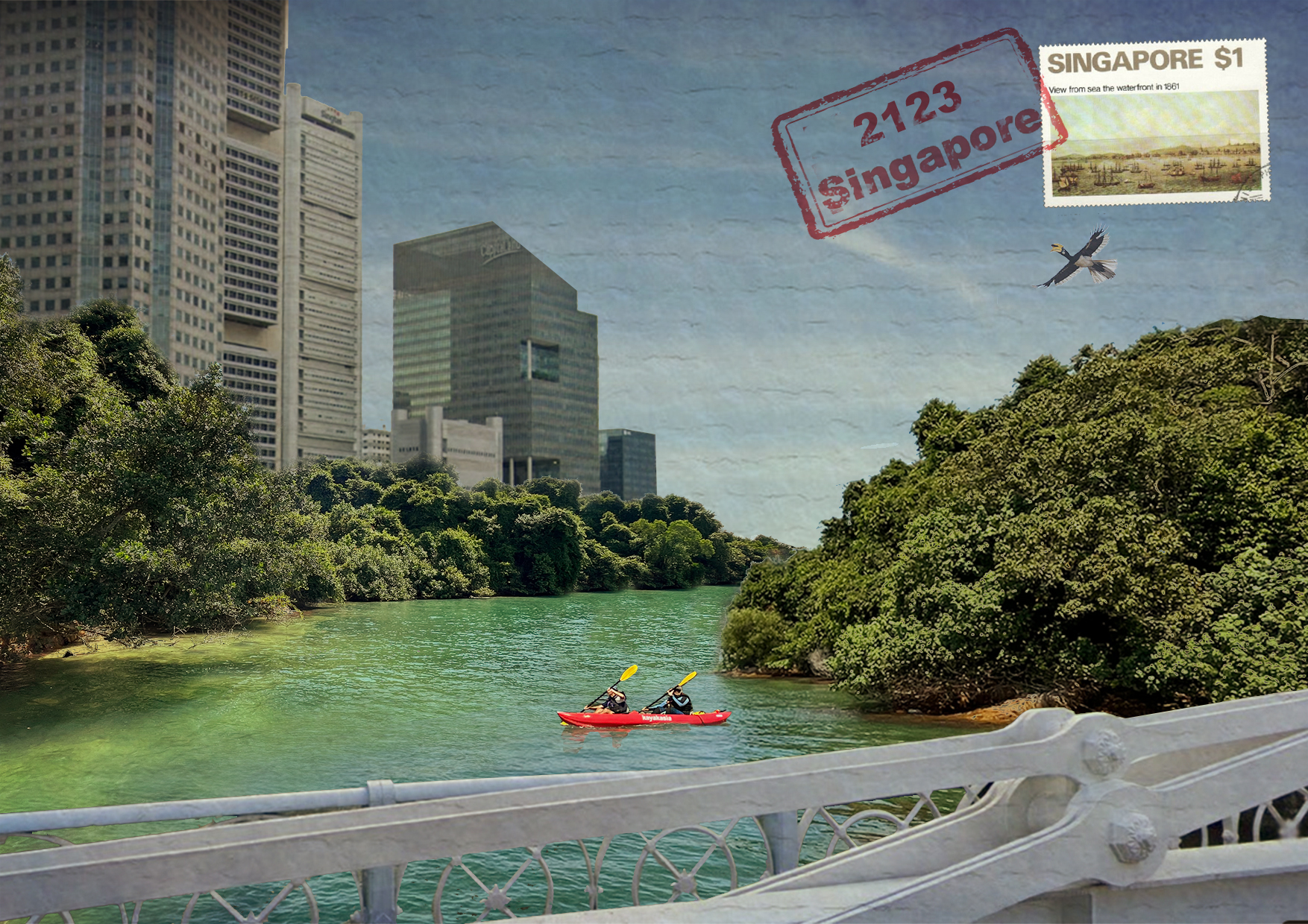
Image of Adapting Waterfronts Postcard from the Future - Site #15 Cavenagh Bridge (Credit: Gabriel Tenaya Kaprielian)
Imagine a postcard sent from Singapore 100 years in the future. What might someone write back and what images would they send to describe how the country has responded to sea-level rise in the 22nd century?
Adapting Waterfronts: Postcards from the future, Singapore 2100 is an interactive installation that addresses these questions and invites the public to explore the past, present, and potential future transformations of the country’s shoreline.
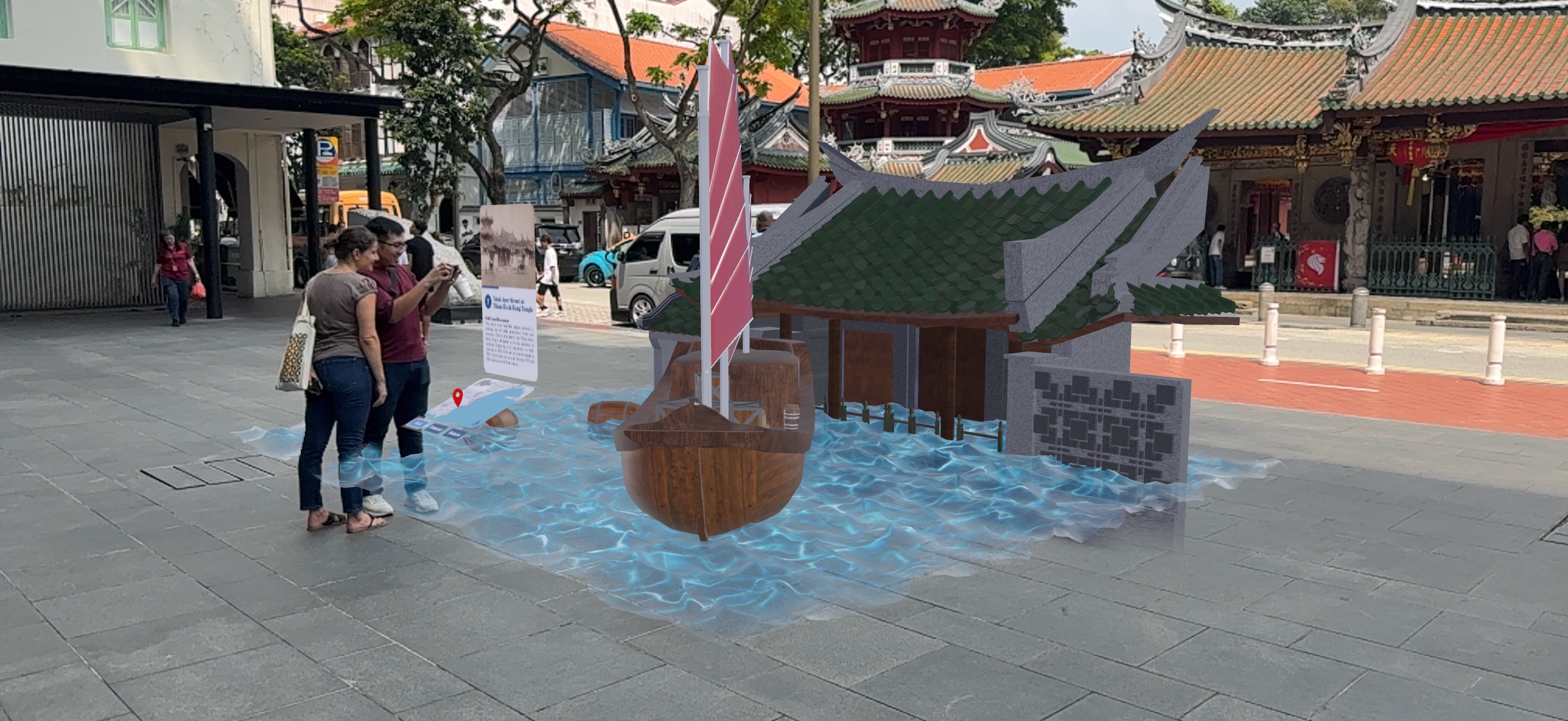
Screenshot image of Adapting Waterfronts Augmented Reality (AR) installation (2026) - Site #7 Thian Hock Keng Temple (Credit: Gabriel Tenaya Kaprielian; AR by Muhammad Hadi Ikhsan)
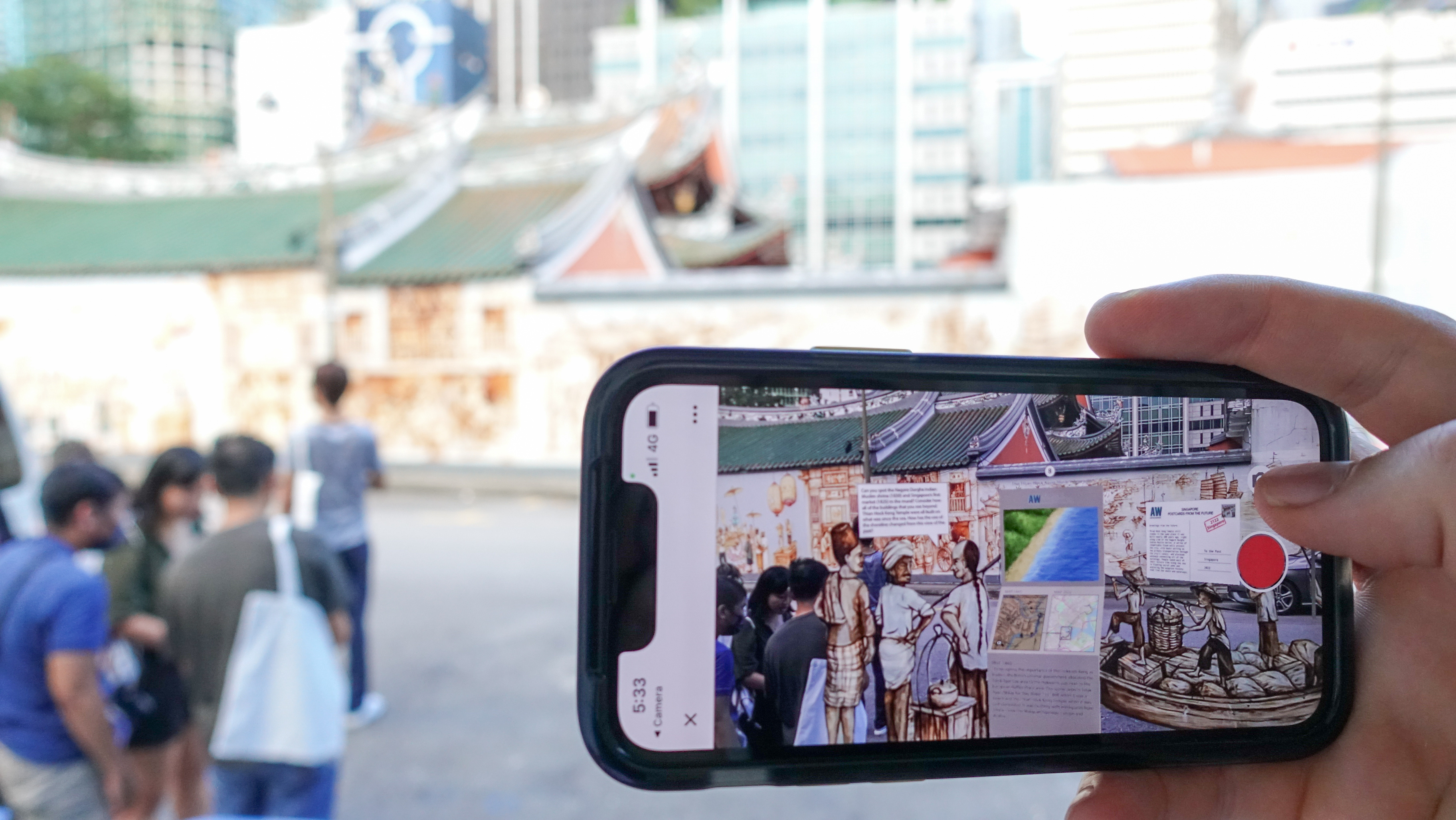
Adapting Waterfronts Augmented Reality (AR) installation (2023) - Site #8 Amoy Street at Thian Hock Keng Mural (Credit: Gabriel Tenaya Kaprielian; Mural and Artwork by Yew Chong Yip)
The installation showcases “Postcards from the Future” created by scientists, architects, and artists, that envision sea-level rise adaptation in the 22nd century. These postcards are included into a guided tour along a proposed heritage trail of Singapore's historic shoreline, which brings the past and future to life through Augmented Reality (AR) installations that visualise place-based changes across time at designated locations.
The Adapting Waterfronts project’s unique breadth draws together the creativity from diverse communities across disciplines fostering transdisciplinary collaboration and international cooperation on the global issue of sea-level rise adaptation. The project seeks to inspire collective optimism and empower informed action by reframing the challenges of sea-level rise as an opportunity for design innovation. "We wanted to create speculative fictions about what the future might bring, and allow you to explore the past, present, and potential future by looking at different artistic visions of sea level rise, adaptation and planning strategies for the future," said Assistant Professor Kaprielian in a 2022 interview with The Straits Times.
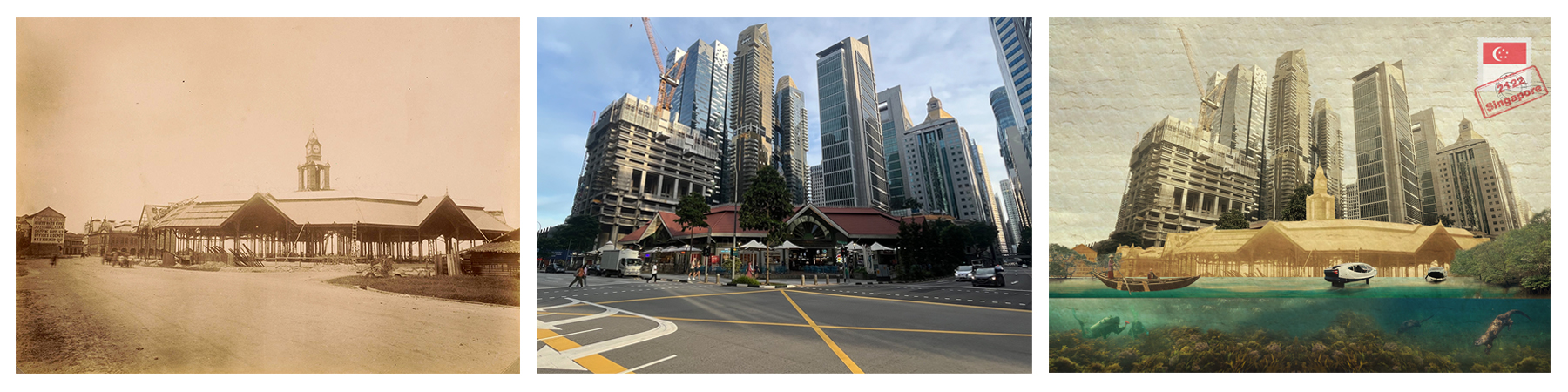
Images from Adapting Waterfronts Augmented Reality historic shoreline trail - Site #11 Lau Pa Sat Market Past, Present, and Future (Credit: Gabriel Tenaya Kaprielian; Source: “The construction of the new Telok Ayer Market,” c. 1890, image no. 2007-50642, Collection of the National Museum of Singapore, National Heritage Board)
While many countries are planning for a projected sea-level rise of one-metre by 2100, high-emission models combined with high tides and storm surge could be as high as 5 metres, which according to the Singapore Green Plan 2030 could potentially flood one-third of Singapore. As it is unknown how fast the ice sheets will melt, combined with the additional effects of increased flooding due to more extreme weather events, coastal cities around the world will need to plan for uncertainty. By providing a platform to exchange knowledge and enable discourse about future sea-level rise, Adapting Waterfronts speculates on how Singapore can develop a long-term planning framework that supports climate change resilience and biodiversity in a win-win strategy. It envisions an increased role of nature-based solutions that embrace tidal ecologies in urban environments as a part of Singapore’s City in Nature vision.
During a 2022 interview with ChannelNewsAsia, Assistant Professor Kaprielian highlighted how augmented reality can provide a platform for building knowledge and collaboration that bring people together at real-world site locations for an immersive experience. At each of the 24 site locations, he describes how the installations visualise different sea-level rise scenarios and potential climate adaptation strategies.
The Adapting Waterfronts project was developed by Gabriel Tenaya Kaprielian, Assistant Professor of Architecture at California Polytechnic State University, San Luis Obispo, as part of a U.S. Scholar Fulbright, in collaboration with the Earth Observatory of Singapore at Nanyang Technological University Singapore. Additional support provided by the Collection of the National Museum of Singapore, National Heritage Board, the National Archives of Singapore, and a grant from the U.S. Embassy in Singapore.

Image of Adapting Waterfronts AR Tour – Site Map (Credit: Gabriel Kaprielian; Source: “The Plan of the Town,” 1843. Image No. XXX-02115, Collection of the National Museum of Singapore, National Heritage Board)
Access information
Adapting Waterfronts: Postcards from the Future, Singapore 2100 is free to access for all.
Self-guided walks of the Augmented Reality historic shoreline trail are available, taking place along an approximately 7.5km path that extends from Shenton Way to the Victoria Street Bridge. Visitors can start anywhere along the path and stop at sites to visualise the past, present, and future. Visit the web-based tool: https://adaptingwaterfronts-sg.org/
Interactive Augmented Reality (AR) installations are located at site 1, 5, 7, 8, 11, 13, and 15.
Created in 2026 by Muhammad Hadi Ikhsan at the Earth Observatory of Singapore (EOS), these new installations use the Unity software platform to create an immersive AR experience. The AR installations contain three-dimensional models, maps, contextual information, and postcards from the future created by artists and participants of workshops hosted by EOS.
Email questions to Gabriel Tenaya Kaprielian: adaptingwaterfronts@gmail.com
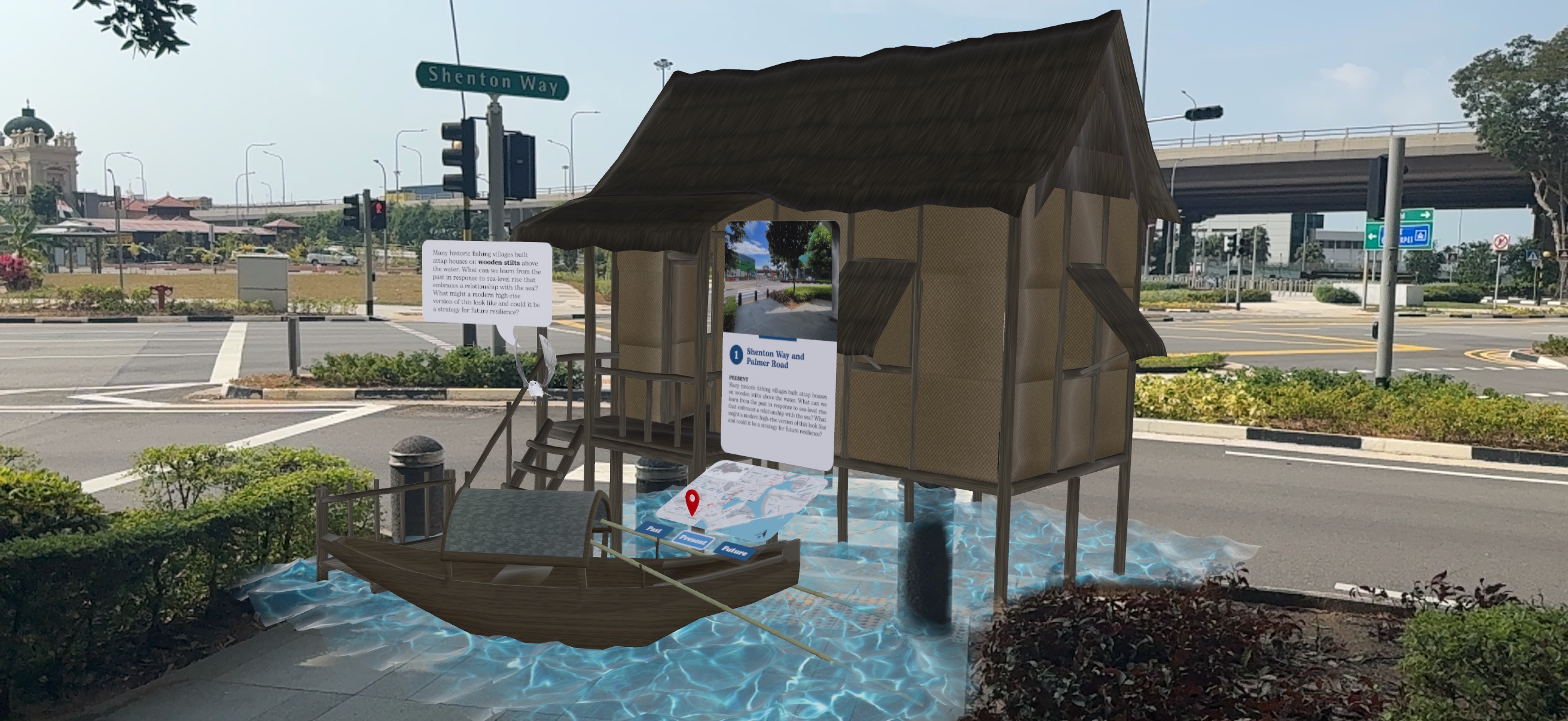
Screenshot image of Adapting Waterfronts Augmented Reality (AR) installation (2026) - Site #1 Shenton Way and Palmer Road (Credit: Gabriel Tenaya Kaprielian; AR by Muhammad Hadi Ikhsan)
In the News:
ChannelNewsAsia, CNA938, Tech Talk, New Augmented Reality Trail: Interview with Daniel Martin, on June 23, 2022: https://www.facebook.com/watch/?v=1411542522643881
The Straits Times, Augmented reality tour imagines parts of Singapore under water in 2122, Rei Kurohi, Published on June 18, 2022: https://www.straitstimes.com/singapore/augmented-reality-tour-imagines-parts-of-singapore-under-water-in-2122