Scientists at the Earth Observatory of Singapore (EOS) and Asian School of the Environment (ASE), at Nanyang Technological University (NTU), and collaborating institutions National University of Singapore and University of Colorado, have demonstrated the potential to use GPS (more generally known as GNSS) technology to track storm surges in coastal settings.
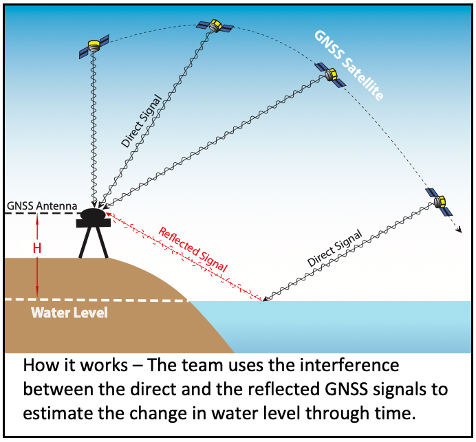
A new study, published on 5 March 2019 in leading journal GPS Solutions, reveals that GNSS signals can be used to track storm surges. Led by EOS Research Fellow, Dr Dongju Peng, the work was supported by a Ministry of Education grant to Associate Professor Emma Hill. “We used a technique called Global Navigation Satellite System - Interferometric Reflectometry (GNSS-IR) and showed that it can be used as an in-situ sea-level monitoring technique,” said Dr Peng.

This technique has significant advantages over traditional tide gauges that must be installed at the water’s edge and commonly fail during major typhoons. The GNSS stations have the advantage in that they can be installed at a relatively high location (e.g. on top of a building), and this reduces the risk of damage during the most energetic storms.

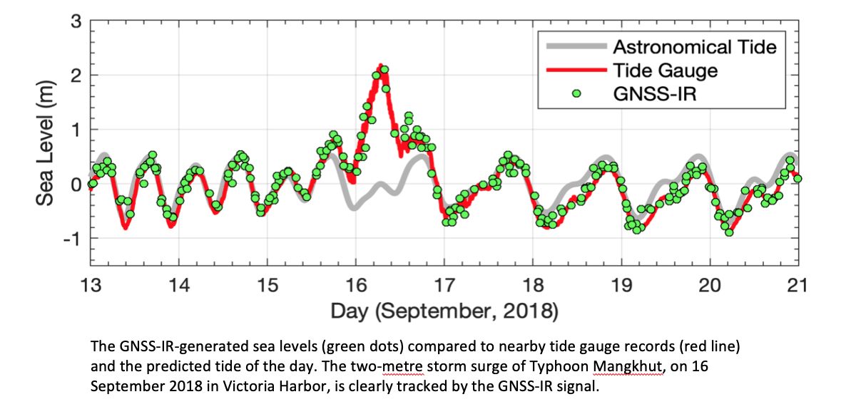
The team used GPS data from two coastal stations to produce sea level measurements during storm surges from Typhoons Hato in 2017 and Mangkhut in 2018 in Hong Kong. Assoc Prof Hill, a geodesist who led the team, commented that “the storm surges caused by the two events are accurately captured by the new GNSS-based technique, agreeing well with traditional tide gauge records.”

Co-author of the study Professor Kristine Larson, from the University of Colorado, added, “This is the first time that GNSS-IR has been used for storm surge monitoring and it highlights the potential of GNSS-IR to detect extreme sea levels caused by storms and tsunamis.
Dr Peng further explained that the team anticipates that “the technique will have broad applications throughout southeast and south asia, especially in the near future when all GNSS signals (including GPS, GLONASS, GALILEO, BEIDOU, etc.) can be used in the data analysis.”