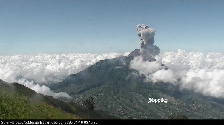
Did you know that in the past six weeks six volcanoes in Indonesia erupted? These volcanoes are Semeru, Anak Krakatau, Merapi, Kerinci, Dukono, and Ibu.
These recent eruptions are part of the usual volcanic bustle in Indonesia, impacting mostly the areas close to the volcanoes. While some of these activities were picked up all the way in Singapore, all were reported to aviation authorities.
Issuing Eruption Notifications
The Centre for Volcanology and Geological Hazards Mitigation (CVGHM), the monitoring agency for Indonesian volcanoes, issued a Volcano Observatory Notification for Aviation (VONA) on each eruption. The notification includes a summary of the volcanic activity, the Aviation Colour Code and, where possible, the height of the volcanic cloud.
CVGHM’s Aviation Colour Code is currently Orange for Semeru, Merapi, Kerinci, Anak Krakatau, Ibu, and Dukono. This means that the plume height of the volcanoes is less than 6000 metres (m) above sea level.
The Volcanic Ash Advisory Centre (VAAC) in Darwin, Australia, issued Volcanic Ash Advisories (VAA) in response to these eruptions. This Centre is responsible for advising the aviation industry on the potential presence of volcanic ash in the atmosphere from the Indonesian region, among others.
VAA informs on the location of ash observed by satellites, pilot reports or volcano observatories, and provides ash cloud forecasts. Heights are reported in Flight Levels (FL). For example, the FL140 reached by the Semeru ash cloud on 12 April (at 23:16 UTC) corresponds to 14,000 feet (or 4267 m) above sea level.
VAA assigns an Aviation Colour Code (defined by the International Civil Aviation Organisation) where Orange indicates that the volcanoes are “exhibiting heightened unrest with increased likelihood of eruption OR that an eruption is underway with no or minor ash emission”.
Differences in the Notifications
Interestingly, the Aviation Colour Code is defined differently by CVGHM and VAAC.
The volcanic cloud height in a VONA can be lower than that in VAA. This can happen when the volcano observer does not see the top of the volcanic cloud from the ground. The VONA would then state that the ash-cloud top “may be higher than what can be observed clearly”.
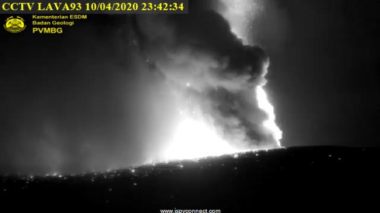
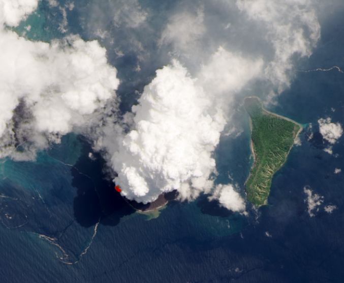
Meteorological conditions may also affect the estimates of volcanic cloud location in VAA. For example, the VAA on 10 April (at 19:05 UTC) for the Anak Krakatau eruption highlights a “low confidence in VA [Volcanic Ash] height, as high-level cloud mass may be a thunderstorm triggered by eruption to lower level”.
A VAA even provided a report on an eruption at Gede/Salak on 10 October 2018 which was later discarded. The apparent plume that triggered the report was due to a strong and rapidly growing weather anomaly.
Infrasound Monitoring of Eruptions
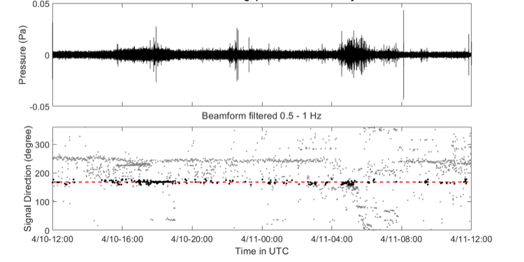
Scientists from the Earth Observatory of Singapore conduct research on using infrasound sensors to characterise volcanic eruptions from safe distances. For example, the Singapore Infrasound Array successfully recorded the eruptions at Anak Krakatau on 10 to 12 April 2020. Such research could help improve eruption detection and the forecasts of ash dispersal.
The Official Channels of Information
None of the eruptions received a lot of media attention. Some pictures of Anak Krakatau posted on Twitter were actually pictures of an eruption that took place back in 2018.
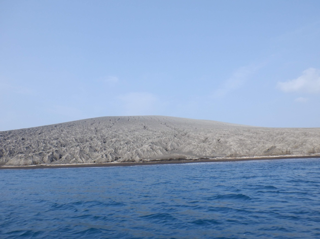
All of these eruptions were smaller than the 2018 eruption at Anak Krakatau which triggered a tsunami, as well as the large eruption at Merapi in 2010 that strongly impacted the region. While these volcanoes are capable of bigger eruptions, these small ones occur more commonly and can affect aviation and local communities.
Semeru, Anak Krakatau, Merapi, Kerinci, Dukono, and Ibu are all at Volcanic Alert Level 2 (advisory) at the time of writing this article, indicating increasing activity or past eruptions with only local impact. Please follow CVGHM for further updates on the activities of the Indonesian volcanoes.