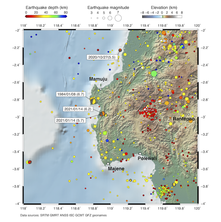
A moderate earthquake struck western Sulawesi, Indonesia, on 15 January 2021 at approximately 2:28am (SGT). According to the United States Geological Survey, the Mw 6.2 event occurred about 36 kilometres (km) south of Mamuju on the island of Sulawesi at a depth of 18 km.

This event follows a smaller Mw 5.7 foreshock event that occurred approximately 12 hours earlier at about the same location.
Today’s event is due to compressional forces on a fault system that has left a visible record in the topography and geology. However, not many earthquakes have happened on this fault system in the recent past. “The east-dipping thrust fault here is part of an obscure system of faults that extends offshore and is not well studied,” said Dr Kyle Bradley, a Principal Investigator at the Earth Observatory of Singapore (EOS).
Sulawesi island is located at the junction of the Eurasian, Australian and Pacific plates, which makes it an active seismic region. The island was struck by the devastating Mw 7.5 Palu earthquake in 2018, about 250 km north of today’s event. That earthquake occurred on the Palu-Koro Fault, a different fault system from the one that slipped in today’s event. Because the earthquake triggered both a devastating local tsunami and landsliding, it killed more than 4,000 people.

The earthquake occurred near the western coast of Sulawesi, which borders the Makassar Strait. This strait has hosted a number of historical tsunamis. Some studies have suggested that these tsunamis may be related to submarine landslides along steep slopes within the strait.
“We saw in the 2018 Palu earthquake that these sorts of steep submarine slopes can be destabilised by ground shaking, producing rapid and damaging tsunamis,” said Assistant Professor Judith Hubbard, a Principal Investigator at EOS.
Today’s earthquake occurred less than 20 km away from the steep drop-off on the western edge of Sulawesi. “Seismicity in this region could potentially trigger a submarine landslide that could inundate the coast of western Sulawesi, and possibly even reach parts of eastern Borneo,” added Asst. Prof Hubbard.
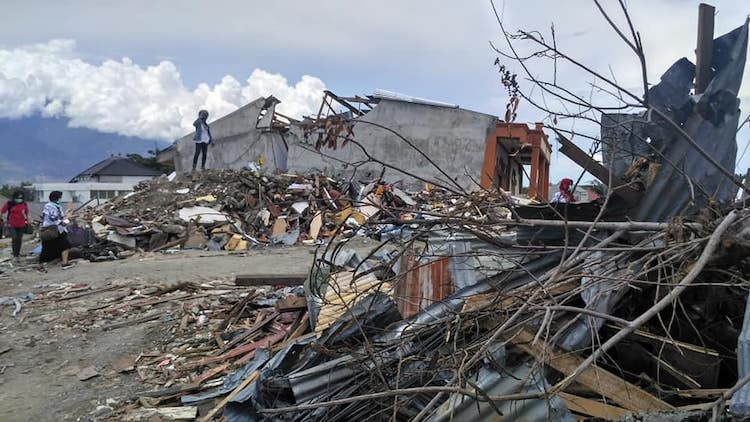
Today’s relatively shallow event was strongly felt in the Sulawesi region, and it caused hundreds of casualties. It also led to strong damage to infrastructure in nearby cities such as Mamuju.
“Because of the lack of knowledge, it’s difficult for scientists to anticipate whether there is a significant risk of larger earthquakes in that region in the days and weeks ahead,” said Asst. Prof Aron Meltzner, a EOS Principal Investigator.
However, “people should be informed and prepared as the region could produce larger events in the future,” reminded Asst. Prof Hubbard. Due to the potential of a tsunami hazard, she advises that “people close to the coast should evacuate uphill if they feel ground shaking until they are confident that no tsunami was generated.”