Sea-level rise could change the coastline of many cities around the world, including Singapore. In fact, rising seas have affected Singapore’s coastline before, as we know from a recent study by the Earth Observatory of Singapore (EOS) that the sea level around Marina Bay 10,000 years ago was 20 metres below today’s level. How did the coastline change as sea-level was rising to today’s level? The information is now hidden under water, and will be key to assess strategies to adapt to future sea-level rise.
I recently led a team of international scientists to map the seafloor of the Singapore Strait, and to characterise the rock layers beneath, to help establish how the Strait formed and how it will respond to climate change and rising seas.
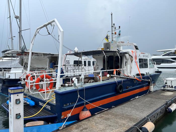
Over ten days, we navigated the seas of the Singapore Strait aboard the Galaxea research vessel of the Tropical Marine Science Institute, on which we had attached several instruments to collect data along the way. Our small-scale geophysical survey revealed intricate details about the Strait’s seafloor.

The Galaxea Research vessel that we equipped with a Norbit iWBMS multibeam sonar and boomer sub-bottom profiler systems (Source: Abang Nugraha/Earth Observatory of Singapore)
We used a high-resolution multibeam sonar to map the topography of the seafloor, and boomer sub-bottom profiler systems to charaterise the rock layers of the subsurface. We navigated over 746,213 kilometres along a predefined pattern of survey lines stretching from Tuas through Southern Islands to Coney Island in the East.

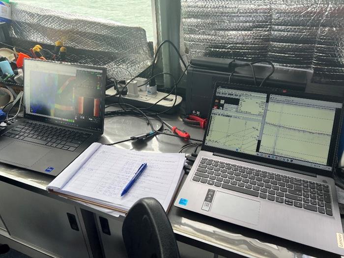
Work desk setup on the boat. Bathymetry and sub-bottom profiling data are recorded and displayed in these workstation laptops. (Source: Abang Nugraha/Earth Observatory of Singapore)
Such a survey is no mean feat, and I had gathered a team of experts, including Research Associate Yu Ting Yan and Research Assistant Professor and project lead Stephen Chua from EOS, as well as scientists from the University of KwaZulu-Natal in South Africa, and from Haifa University in Israel.

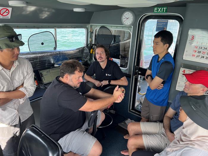
Discussion between EOS researchers, collaborators and visitor from PUB on the boat. From left to Right: Dr. Abang Nugraha (from the Coastal Lab at EOS), Mr. Doug Slougrove (University of KwaZulu-Natal), Prof. Andrew Green (University of KwaZulu-Natal), Dr. Stephen Chua (from the EOS Sea Level Research team), Prof. Uri Schattner (Haifa University) and Ms. Farzana Miswan (PUB Project Manager) (Source: Abang Nugraha/Earth Observatory of Singapore)
The detailed bathymetry and subsurface image data will help us characterise the deep water currents, the distribution of offshore sediments, and the stratigraphy of the subsurface. By putting all this information together, we aim to reconstruct the history of the Singapore Strait landscape, which will help assess the impacts of climate change and sea-level rise in the area.
This survey is a big step forward to study Singapore's marine environments. It will provide key information to help Singapore adapt to climate change and rising sea levels.

The smiles of the team show the success of the geophysical survey (Source: Abang Nugraha/Earth Observatory of Singapore)
This survey was supported by the National Research Foundation and PUB, Singapore’s National Water Agency, under the award-winning competitive funding for a water research grant project titled 'Baseline data collection and projections of the impacts of climate change on Singapore’s offshore water resources’. The project is led by EOS Research Assistant Professor Stephen Chua.
Any opinions, findings and conclusions or recommendations expressed in this material are those the author(s) and do not reflect the views of PUB, Singapore’s National Water Agency.