Assistant Professor Sylvain Barbot discusses the scientific implications of the data gathered from the search for flight MH370 on Channel NewsAsia

Since Malaysia Airlines flight MH370 went missing over two years ago, the world has waited with bated breath for news of its discovery. A massive search for the aircraft recently ended without conclusive results. While the disappearance of MH370 remains a tragic mystery, the search could provide valuable data to scientific communities.
Ms Glenda Chong and Mr Steve Lai, co-hosts of Channel NewsAsia’s PrimeTime Asia programme, spoke with Assistant Professor Sylvain Barbot last Friday about the scientific implications of this data.
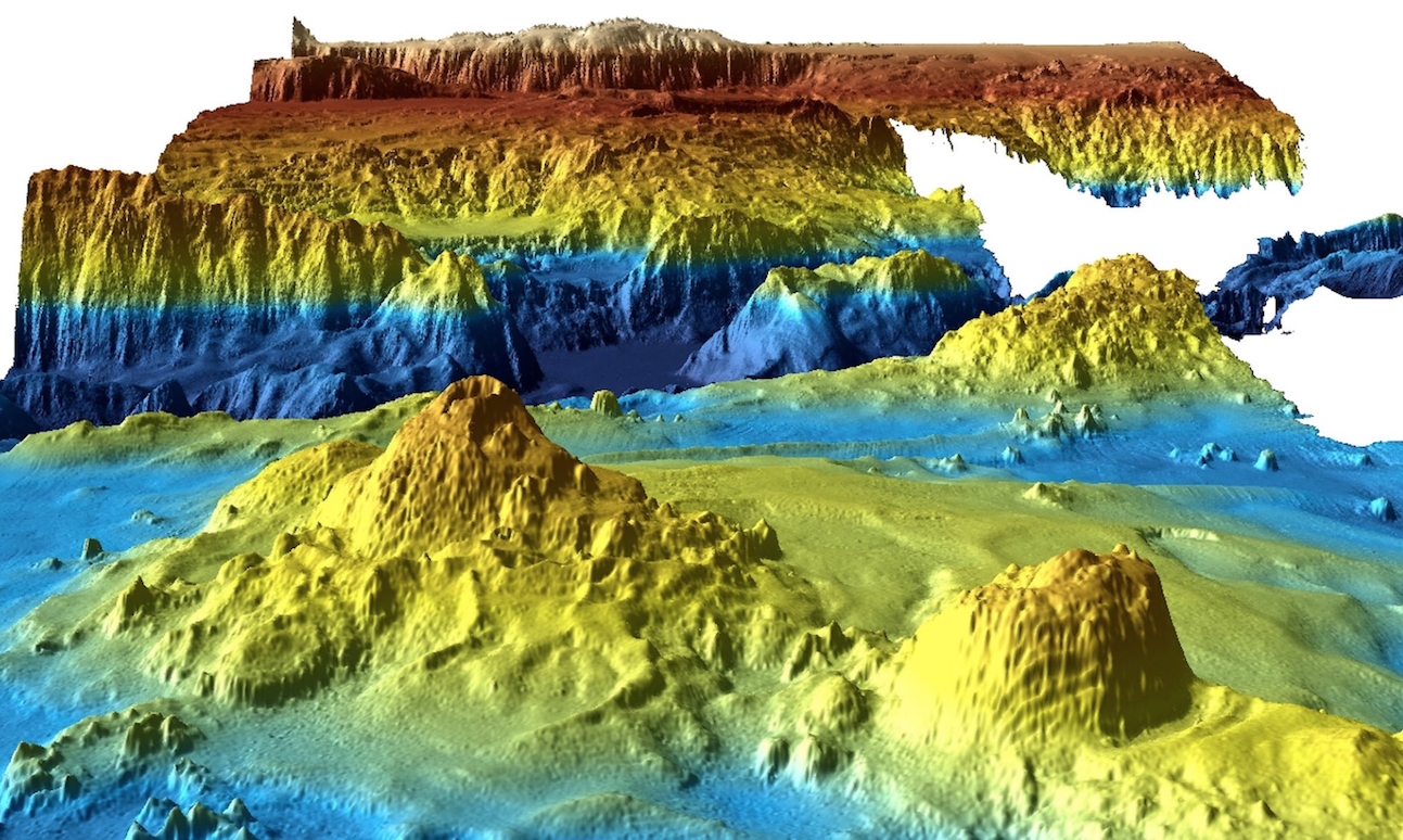
Asst. Prof Barbot, a Principal Investigator of the Tectonics Group at the Earth Observatory of Singapore (EOS), explained that this new dataset is not only unprecedented in its size, but is also unique because it will be free and publicly available. As such, the data holds immense scientific and educational value.

Students at the Asian School of the Environment at Nanyang Technological University, for example, are trained to analyse this kind of data to map out the geological history of the Earth. Having access to such a dataset will provide these students an outstanding opportunity to put their training into practice.
Asst. Prof Barbot admitted that while “more than two-thirds of the surface of the Earth is covered by the ocean, we know the surface of planetary bodies, like Mars, much better than we know the surface of the Earth under the ocean.” Given this, datasets like the one collected in the search for MH370 provide scientists a chance to see parts of the seafloor for the very first time.

When Glenda asked Asst. Prof Barbot why such large-scale seafloor mapping has not been done before, he explained that this method of data collection is extremely expensive – about S$100,000 per day. This high cost, along with the danger of being at sea for long periods of time, are reasons why such important research is not often done. He added that “it is often the case that disasters prompt more immediate action.
When Steve asked about what contributions Singapore is making towards this field, Asst. Prof Barbot highlighted the important work being done by scientists at EOS. He explained that last year, EOS led a massive survey of the Indian Ocean seafloor, about one-fourth the size of the survey conducted in the search for MH370.

He added that scientists at EOS are leading the way in this discipline today, finding new and more economical ways to map the seafloor using robots and unmanned vehicles.
Asst. Prof Barbot explained that the dataset gathered from the search for MH370 will allow scientists to be much more precise in terms of the kind of hazards we can expect from this region.
“Every time we are able to map the seafloor,” he said, “this can be transformed into information that can help us protect coastal areas, resources, and people.”