At 12:03 pm Singapore time on 6 February 2023, a few hours after the Mw7.8 earthquake struck Türkiye and Syria, Sentinel Asia was activated for the event and, shortly after, the World Food Programme requested support from the Earth Observatory of Singapore (EOS) at Nanyang Technological University, Singapore (NTU Singapore) to produce maps showing the areas likely damaged by the earthquake. The EOS Remote Sensing (EOS-RS) Lab promptly worked with several agencies to produce and release a damage proxy map to support relief efforts.
To develop these maps, scientists from EOS-RS first worked with the Japan Aerospace Exploration Agency (JAXA) to collect satellite data over the impacted areas using their Advanced Land Observing Satellite-2 (ALOS-2). These impacted areas had previously been imaged by the satellite on 7 April 2021 and 6 April 2022.
JAXA tasked their satellite on 8 February to collect new data with its Synthetic Aperture Radar (SAR) sensor that can see the Earth surface under all-weather conditions day and night. Data were collected over a large area (70 km x 236 km) covering the epicentre of the earthquake and several major cities in Türkiye and Syria which were reported to have been strongly affected by the earthquake. These include Kahramanmaras, Nurdagi, Islahiye, and Aleppo.
As soon as the SAR data were provided through the international cooperation project Sentinel Asia, EOS-RS started processing them and estimated how much the Earth surface changed between the latest satellite image and those collected before the earthquake. Since EOS-RS has a long-standing collaboration with JAXA, Sentinel Asia, World Food Programme, and NASA-Jet Propulsion Laboratory (NASA-JPL), these partners also coordinated with EOS-RS and provided their inputs on the locations of the impacted area.
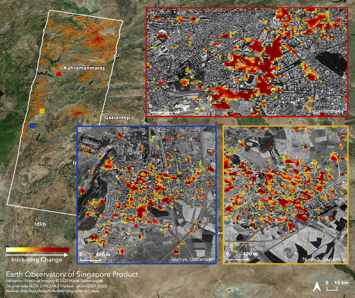
After comparing the final results with high-resolution optical imagery and media reports for consistency, EOS-RS produced and released the first damage proxy map over Türkiye and Syria on 9 February, 2.03 am Singapore time.

Damage proxy map produced by the Earth Observatory of Singapore Remote Sensing Lab. More details and information can be found here: https://eos-rs-products.earthobservatory.sg/EOS-RS_202302_Turkiye_Syria_Earthquake/
On the map, each pixel measures about 30 metres across and the colour variation from yellow to red indicates increasingly more significant surface change. These Earth surface changes seen by the satellite are areas likely to have suffered damage. “The map immediately contributes to situational awareness for the event response and provides critical information for decision-makers such as the World Food Programme, as they quickly need to know how many people are affected,” said Associate Professor Sang-Ho Yun, Director of EOS-RS.
EOS-RS disseminated the map to the World Food Programme through Sentinel Asia, and to the public via its website. The information about the map was also shared through the EOS-RS Twitter account (@eos_rs) in the early morning of 9 February. “We made the processed data publicly available for other scientists and agencies to use, and to support relief efforts as much as possible,” said Assoc Prof Yun.
The maps are currently being used by the World Food Programme for quantitatively estimating the number of affected people. Through Twitter, EOS-RS was introduced to the director of rescue operation in Türkiye, and more recent maps were directly shared with the rescue operation team. Over the following weekend, EOS-RS produced four more maps from satellite data including new acquisitions by the Copernicus Sentinel-1 satellite operated by the European Space Agency (ESA).
The maps attracted strong interest from the public and the media. At the time of writing, the initial EOS-RS tweet has been viewed more than 180,000 times, and the efforts of the lab have appeared in several international news outlets. In Singapore, the efforts were further promoted online by the University, its Earth Observatory of Singapore and School of Electrical and Electronic Engineering, as well as external agencies such as the Office for Space Technology and Industry, Singapore.
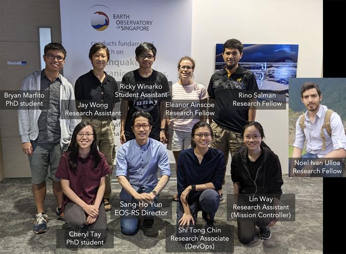
 The team from the Earth Observatory of Singapore Remote Sensing Lab (Source: Earth Observatory of Singapore)