Lava flows are deadly streams of molten rock that sometimes erupt from volcanoes around the world. Their destructive power can be immense – they can bury vast areas of land under hundreds of metres of volcanic material and damage a range of infrastructure. In our new study, we provide a comprehensive assessment of how these lava flows impact the built environment. This will help us prepare for future eruptions.

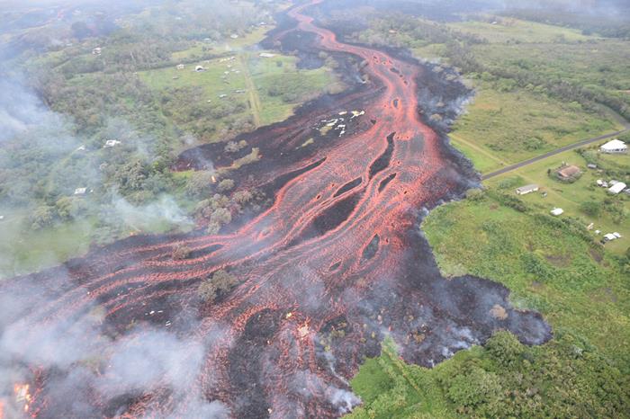
Lava flow channels during the 2018 eruption of Kīlauea volcano, Hawaii, USA (Source: U.S. Geological Survey)
Depending on the lava effusion rate and viscosity, as well as the land topography, lava flows can travel for hundreds of kilometres (km) and up to speeds of 10 km per hour on steep slopes. Whilst deaths are rare, lava flows have devastated communities around the world. The 2021 lava flows at Cumbre Vieja, La Palma in Spain, Nyiragongo volcano in the Democratic Republic of Congo, and the 2018 eruption at Kīlauea volcano, Hawaii in the United States have destroyed thousands of buildings. Lava is also a hazard in Southeast Asia, with 60 recorded lava flows at volcanoes in Indonesia and the Philippines in the last 50 years.
Eruption of lava flows often prompt evacuations of communities in volcanically active regions, but do not always damage structures. This recently happened at Merapi, Indonesia in March 2022 and at Mayon, the Philippines in 2018. Other times, the lava flows did impact communities and structures, such as during the 1976 eruption of Karangetang, Indonesia, when the lava flows destroyed 24 homes, and 44 others in the flow path were dismantled to avoid destruction.
In our recent study published in the Bulletin of Volcanology, in collaboration with the U.S. Geological Survey (USGS) and GNS Science, we investigated the impacts of the 2018 lava flows of Kīlauea volcano. This event provided a rare opportunity to record and assess the damage from lava flows, which greatly contributes to the global empirical dataset of lava impacts.
We collated imagery from remote sensing and our field surveys, and compiled the largest available dataset of lava flow impacts. We also developed a novel scale of building damage severity – the first set of damage states made specifically for lava flows. We then used the damage imagery and the damage state scale to categorise all of the buildings in the area by the severity and type of damage. By understanding how the intensity of the lava flows results in each damage state, our work helps better forecast what future damage may be like at a given hazard intensity.

Building damage states used to classify buildings by damage severity, the first developed for lava flows. (Source: Elinor Meredith and Nguyen Thi Nam Phuong/Earth Observatory of Singapore)
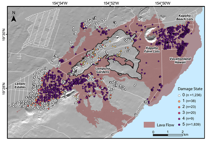
In May 2018, lava flows erupted from fissures in the residential Leilani Estates, in lower Puna, on the west of Hawai`i Island, and lasted until August. The flows inundated an area of 32.4 km2, destroyed 1,839 and damaged 90 structures – a record number of impacted structures from a lava flow event on the island. The flows destroyed farmland and a multitude of tourist areas, including tidepools. They also created a new beach south of the flow.

A map of buildings impacted by the lava flows, coloured by damage severity from no damage visible (0) as white to complete destruction (5) as purple (Source: Elinor Meredith/Earth Observatory of Singapore)
We found that the impacts caused a range of damage severity, from minor melting of plastic coverings and corrosion of metal, to complete destruction. We also found a pattern: circular and metal structures were more resistant to thinner flows compared to wooden homes. This indicates that structures made of more resistant materials in a circular shape are more resistant to the impacts of lava flows.
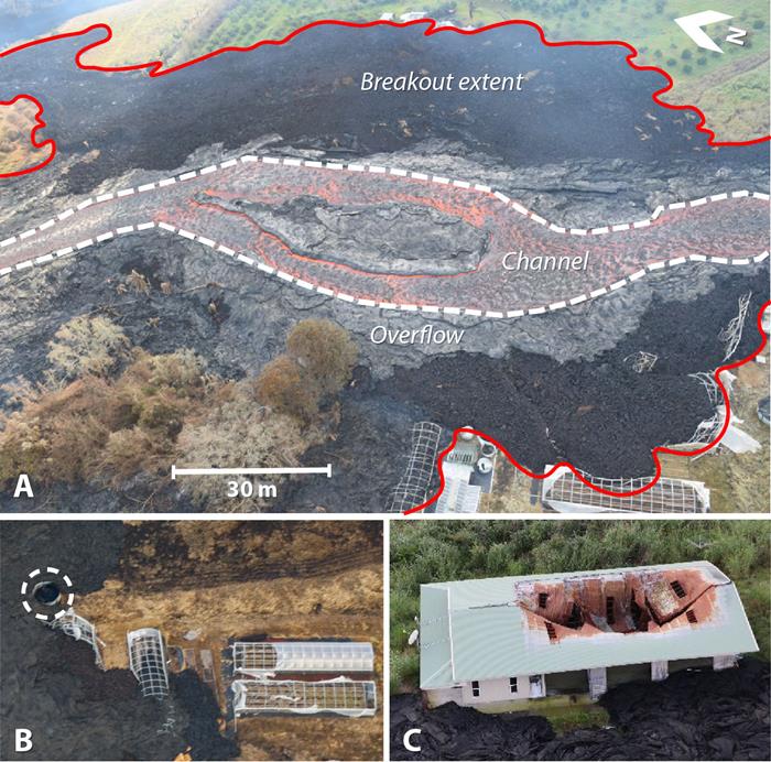
During the 14 weeks of the eruption, most impacts to structures occurred within the first four weeks when the main lava channels were being emplaced. Many structures were destroyed in later breakout flows and overflows when lava broke away or overtopped from the main channels. Therefore, even if buildings close to the lava channel are not initially impacted, they can still be at risk from later breakout and overflows.

Photographs of damage to structures along the lava flow margin at the breakout and overflows from the lava flow channel (Source: Meredith et al. 2022)
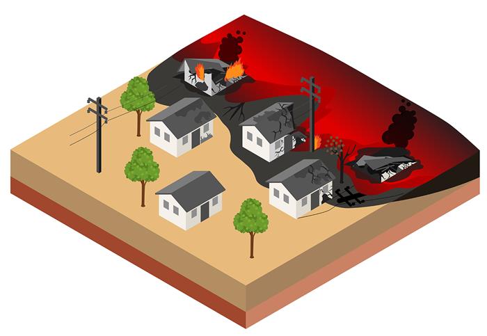
During the eruption, structures are also at risk of a myriad of other hazards from secondary fire spread, tephra fall, ground cracking, and gas emissions. We recorded fire damage almost 600 metres away from the edge of the lava flow. Future hazard assessments should therefore include a wide boundary of potential impacts beyond the flow.
Lava flows made some structures inaccessible in islands of land surrounded by lava known as kīpukas. Many of these structures had less severe or no damage, but were still be impacted by lack of access. In addition, potential destruction of nearby utilities such as water or electricity has likely slowed down their recovery.

Lava flows can damage structures along and away from the flow margin (Source: Elinor Meredith and Nguyen Thi Nam Phuong/Earth Observatory of Singapore)
By providing a better understanding of the interactions between lava and the built environment, we hope that our results can help improve future risk assessments and the prediction of impacts, as well as support local authorities in implementing measures to mitigate losses from future eruptions in Southeast Asia and beyond.
We want to thank the residents of lower Puna for kindly allowing access to properties during fieldwork in the aftermath of the eruption. We also thank our collaborators at the USGS Hawaiian Volcano Observatory (HVO), GNS Science, and the University of Hawai`i at Hilo (UHH).