The Mw 5.6 earthquake that struck West Java on 21 November 2022 was not as strong as those that can occur offshore along the plate boundaries. The earthquake happened inland on a fault west of Bandung, and it caused hundreds of casualties and strong damage to infrastructure.
Two scientists from the Earth Observatory of Singapore, Associate Professor Sang-Ho Yun and Assistant Professor Shengji Wei shed light on what happened and what we can expect in the future.

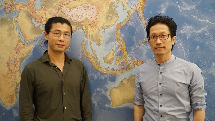
Assistant Professor Shengji Wei (left) and Associate Professor Sang-Ho Yun (right) (Source: Lauriane Chardot/Earth Observatory of Singapore)
1. Where was the damage caused by the earthquake?
Associate Professor Sang-Ho Yun:
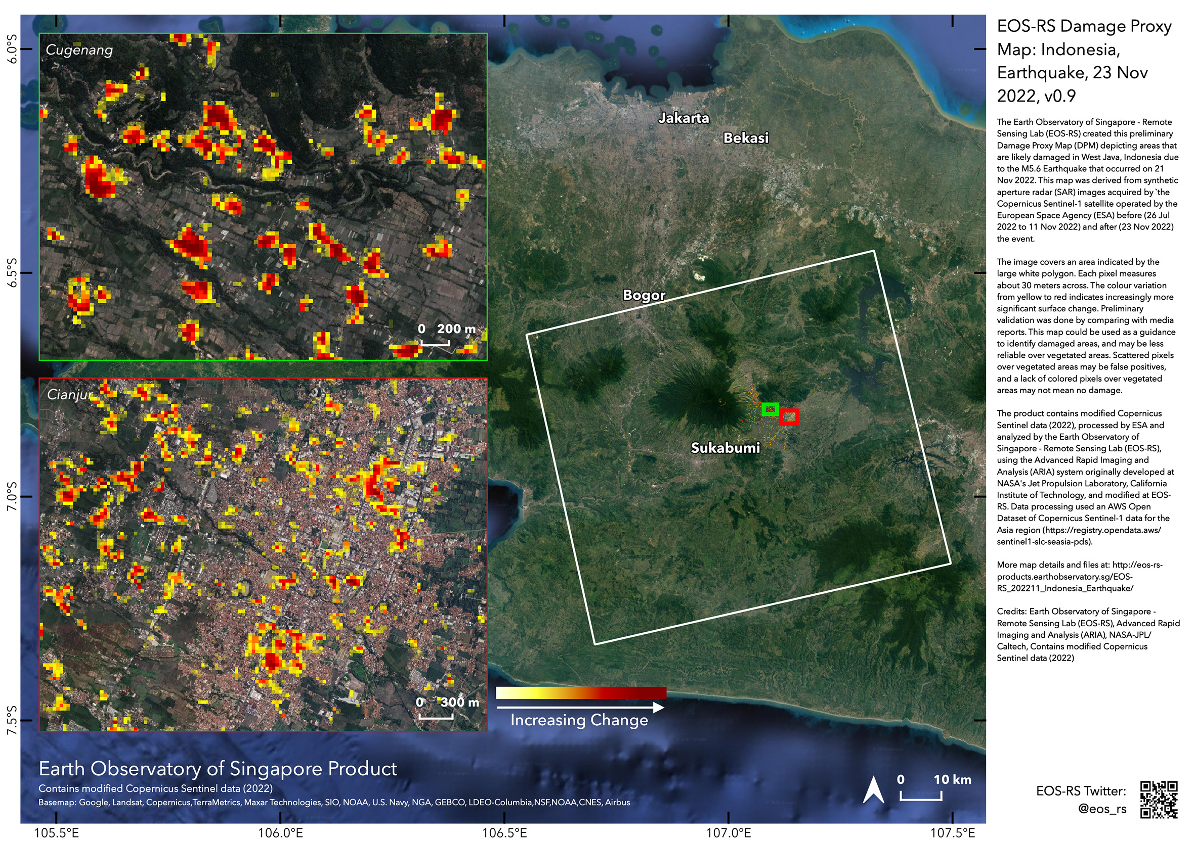
“We know from local authorities that many buildings were damaged, and that there were landslides in the region of Cugenang. Following the event, the EOS Remote Sensing Lab (EOS-RS) produced a damage proxy map (DPM) of the region around the earthquake epicentre. The map shows how much the surface of the Earth has changed between two satellite images acquired before and after the earthquake. Changes of the Earth surface can be due to buildings that have been damaged by the earthquake or land damage such as landslides or liquefaction induced by the earthquake. They can also be due to other changes during the time span of satellite data but not related to the earthquake. This is why we call our map a damage proxy map. In our maps (produced from Synthetic Aperture Radar data acquired by Japanese ALOS-2 and European Sentinel-1 satellites), we see that many areas around Cianjur and Cugenang have changed.”
 2. Why was this earthquake destructive?
Assistant Professor Shengji Wei:
“The Mw 5.6 earthquake that struck West Java on 21 November 2022 was smaller than many other earthquakes happening along the tectonic plate boundaries offshore the island. But this earthquake was quite shallow and close to local populations who felt strong shaking near the epicentre and moderate shaking in Jakarta. The largest ground shaking intensity reported to “
Did you feel it” is intensity VIII. In addition to the shaking, the earthquake triggered landslides, that we call secondary hazards. Landslides commonly occur in the region around earthquake epicentres, especially in areas with steep topography. Rainfalls can further promote landslides due to the lubrication effect. During the Mw 5.6 event, it is actually the landslides together with the strong shaking that have produced the large number of casualties.”
Associate Professor Sang-Ho Yun:
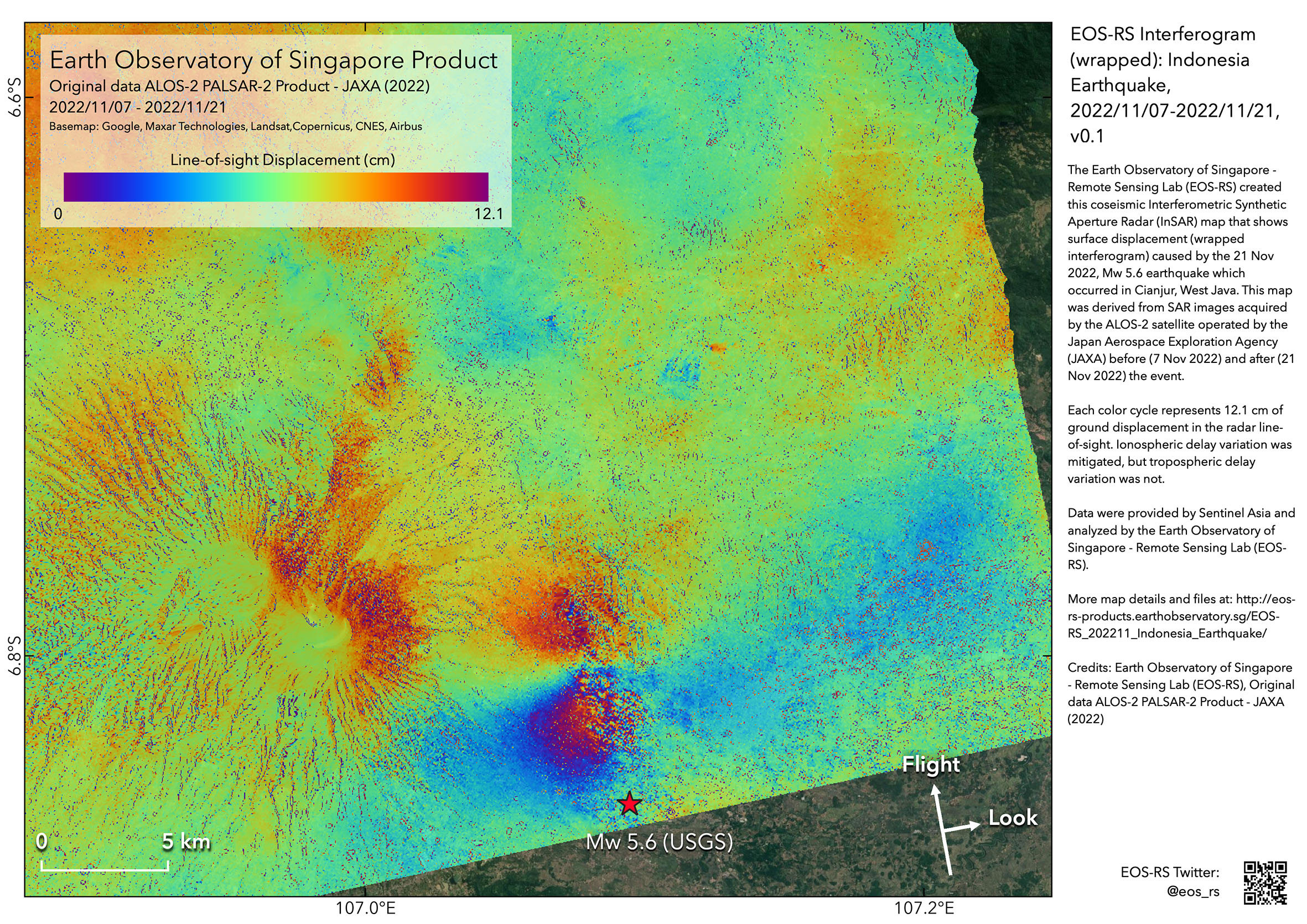
“As a result of the earthquake, we measure that the ground has moved by about 13 to 15 cm in the direction of satellite line of sight. We obtained this result by using Synthetic Aperture Radar (SAR) observations made by the ALOS-2 satellite operated by the Japan Aerospace Exploration Agency (JAXA) and “interfere” the SAR images before and after the earthquake to map how much the ground has moved due to the fault slip that caused the Mw 5.6 earthquake. The earthquake resulted from the slip on a fault whereby the two fault blocks slid past each other. Such ground motion is clearly seen on the deformation map produced by Interferometric SAR or InSAR.”
 3. Are such events common in Indonesia?
Assistant Professor Shengji Wei:
“Moderate size magnitude earthquakes have occurred in the region affected by the Mw 5.6 earthquake. For example, two events with similar magnitude occurred in 1975 and 1982. These earthquakes have a different mechanism from the earthquakes that occur offshore at the boundary of the tectonic plates, but they can still be damaging. Over the years, observations about these earthquakes have allowed to refine the understanding of the seismic hazard in Indonesia and in the region where the Mw 5.6 earthquake struck.”
4. What can happen next?
Associate Professor Sang-Ho Yun:
“Further analyses of the deformation map can provide useful information about the fault slip, such as its location, orientation, extent, depth, amount of the fault slip. Ultimately, this can inform about where this earthquake might have increased or decreased the potential for further earthquakes in the future.”
Assistant Professor Shengji Wei:
“We expect aftershocks of similar or smaller magnitude following this event. Many have already occurred and can continue to occur for a few weeks or months. Sometimes, an earthquake can also lead to a larger event. Although we cannot precisely predict how and when future earthquakes will occur, in-depth studies of this earthquake sequence will be helpful to deepen our understanding of fault geometry, stress condition, seismicity activity and damage pattern, which are critical for future seismic hazard mitigation.”
The maps from this post can be accessed at: https://eos-rs-products.earthobservatory.sg/EOS-RS_202211_Indonesia_Earthquake/
Follow updates from BMKG, CVGHM and the Indonesian local authorities for information about seismicity in Indonesia.