The Earth Observatory of Singapore (EOS) launched the EOS Remote Sensing (EOS-RS) Laboratory, a new flagship laboratory for Earth observations. EOS-RS uses satellite data and innovative algorithms to map, monitor and understand natural hazards, climate change and environmental crises, and support stakeholders in and around Southeast Asia.
The growing number of satellites provides a wealth of data allowing unprecedented Earth observation capabilities. By working closely with the Singapore space industry and processing satellite data in a timely and innovative way, EOS-RS will be at the forefront of hazard and disaster mapping. It will help make societies safer and more sustainable, which is a key aspect of the EOS’ mission. "With our densely populated region facing natural hazards, climate change, and rising seas, there is a clear need for the decision-support information EOS-RS can provide," said Associate Professor Emma Hill, Director of Research and Strategy for EOS.
One of the key tools of EOS-RS is Synthetic Aperture Radar (SAR) satellite observations, which can be made under all atmospheric conditions. "Radar can "see" things during day and night, and through clouds, rain, wildfire smoke, and volcanic plume. SAR-based maps are therefore useful for efficient and effective disaster response and recovery support in and around Southeast Asia," said Assoc Prof Sang-Ho Yun, the Director of EOS-RS.
Prior to joining EOS, Assoc Prof Sang-Ho Yun was a scientist at NASA’s Jet Propulsion Laboratory (JPL) and the Disaster Response Lead of the Advanced Rapid Imaging and Analysis (ARIA) team at JPL and California Institute of Technology (Caltech). Having supported over 100 major disaster events globally, he brings a wealth of experience in disaster response to EOS.
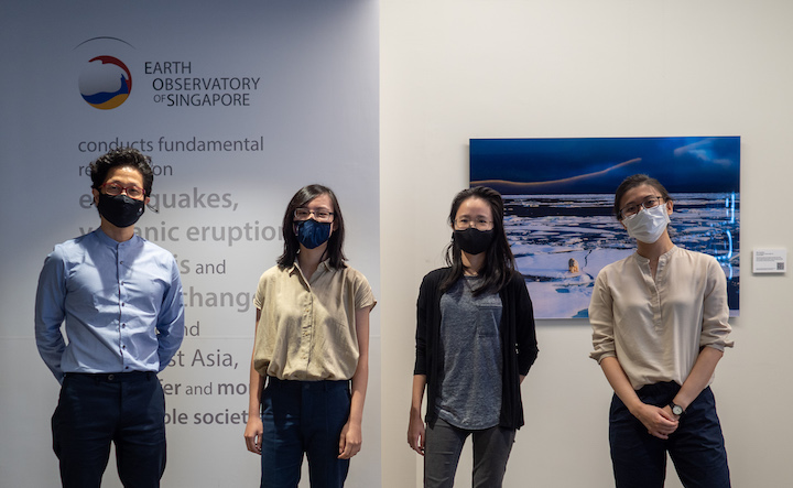
"The EOS-RS lab is starting with four female and one male founding members, and will exercise and promote diversity and inclusion," said Assoc Prof Yun.

EOS-RS uses the ARIA-SG system, which has been used for a few years at EOS for disaster mapping to support regional and international stakeholders with disaster response. ARIA-SG was initially cloned to EOS through a collaboration with NASA-JPL and Caltech, the original developers.
Following requests from organisations such as Sentinel Asia, the ASEAN Coordinating Centre for Humanitarian Assistance on disaster management (AHA), or the World Food Programme, "the ARIA-SG system automatically downloads and processes relevant satellite images of the affected areas to produce preliminary disaster maps. Using reports of the disaster in news, official reports, aerial footage, and social media posts, the team then compares and adjusts these maps to ensure that the final maps match the real extent of flood or damage," said Ms Cheryl Tay, a member of the EOS-RS team.
EOS-RS then disseminates these maps in a timely manner to relevant agencies and through social media to help stakeholders with decision-making.
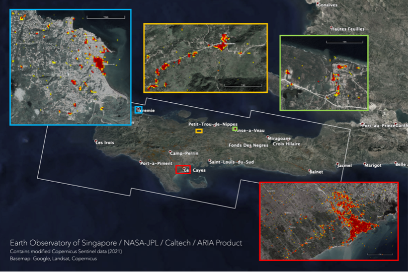
Recent activities of EOS-RS include a response to the Mw 7.2 earthquake that struck Haiti on 14 August 2021. Following a request from the World Food Programme, EOS-RS generated and disseminated a damage proxy map, which shows the areas likely damaged by the earthquake.

In addition to disaster response, EOS-RS will drive innovation in disaster mapping capabilities. “We learn something new from each disaster response, and this feeds back into our research to improve our algorithms and system,” said Ms Chin Shi Tong, another member of the EOS-RS team.
EOS-RS will focus on generating products that are customised for the needs of Southeast Asia. “We will innovate algorithms and systems to address the unique challenges associated with imaging ground motion for earthquakes, volcanic activities, and coastal inundation through tropical forests and wetlands,” said Assoc Prof Yun.
“I am excited to see the impact and innovation that scaling up our remote-sensing activities through EOS-RS can bring to Singapore and the region,” said Assoc Prof Emma Hill. “With an ever-increasing wealth of satellite data, new avenues for analysing huge datasets through tools like Artificial Intelligence, and a great team, there is so much potential.”
EOS-RS has an extensive network of regional and international collaborators and stakeholders, including the Singapore space industry, other research groups at Nanyang Technological University and the National University of Singapore, and international agencies and institutes including NASA-JPL, the Japanese Aerospace Exploration Agency (JAXA), the United States Geological Survey, Caltech, and Peking University.
Reflecting on the benefits EOS-RS brings to the region, Assoc Prof Yun said, “While providing timely decision-support products, we will engage state-of-the-art technology and continue innovation with feedback from stakeholders and partners”.
Follow the EOS-RS team on Twitter at @eos_rs for updates.